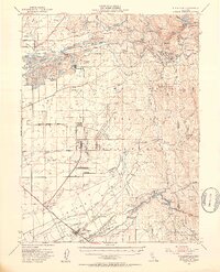
1949 Map of Wheatland
USGS Topo · Published 1953About this map
Camp Beale Military Reservation dominates the central landscape of this mid-century survey, reflecting the significant military presence in Yuba and Nevada counties during and after the war. The topography reveals an intense industrial history along the Yuba River, where massive Tailings deposits and a sprawling Gravel Pit indicate the scale of dredging and mining operations. Further east, the terrain rises into the foothills, dotted with hard-rock legacy sites like the Donnebrouge Mine and the Blue Point Mine.
Find a feature on this map
91 named features on this map. Tap any name to fly to it.
Don’t see what you’re looking for? This feature index may not catch every label — zoom into the map to look around manually.
Map Details
Editions of this 1949 Wheatland Map
3 editions found
Other maps of this area

1888 · Marysville
USGS Topo · 1:125,000

1888 · Smartsville
USGS Topo · 1:125,000

1891 · Sacramento
USGS Topo · 1:125,000

1891 · Marysville
USGS Topo · 1:125,000

1891 · Smartsville
USGS Topo · 1:125,000

1892 · Sacramento
USGS Topo · 1:125,000

1892 · Smartsville
USGS Topo · 1:125,000

1893 · Sacramento
USGS Topo · 1:125,000

1894 · Smartsville
USGS Topo · 1:125,000

1894 · Marysville
USGS Topo · 1:125,000