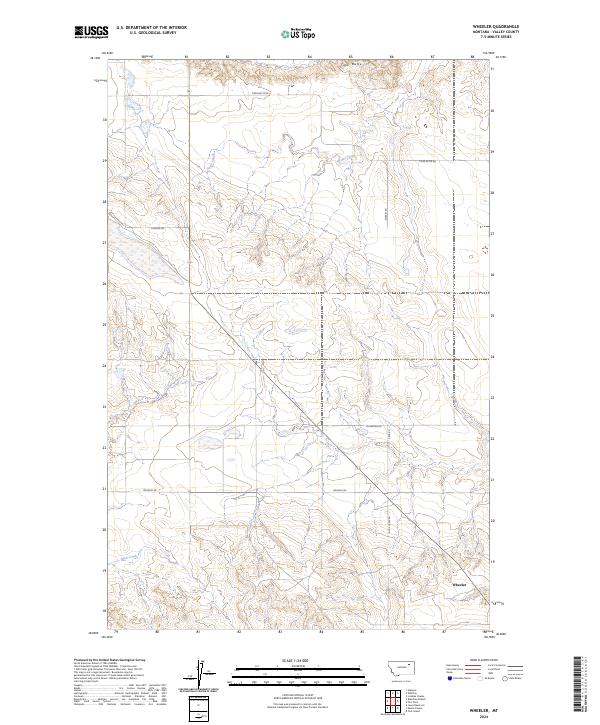
2024 Map of Wheeler
USGS Topo · Published 2024About this map
Wheeler anchors the southeastern corner of this Valley County landscape, situated where the high plains meet the intricate drainages feeding the Missouri River breaks. The topography is dominated by the prominent elevation of Tiger Butte to the north, which overlooks a network of seasonal watercourses including Dogle Creek and Mud Creek. A significant portion of the southern boundary is occupied by the Charles M Russell National Wildlife Refuge, indicating the transition from managed rangeland to protected prairie wilderness. The land is partitioned by a grid of rural routes such as Maxness Rd and Tiger Butte Rd, reflecting the long-standing Public Land Survey System divisions that define the settlement patterns of the Missouri River country. This contemporary survey captures the balance between remote ranching outposts and the vast conservation lands of central Montana.
Find a feature on this map
16 named features on this map. Tap any name to fly to it.
Don’t see what you’re looking for? This feature index may not catch every label — zoom into the map to look around manually.
Map Details
Editions of this 2024 Wheeler Map
This is the sole edition of this map. No revisions or reprints were ever made.
Other maps of this area

1914 · Nashua
USGS Topo · 1:62,500

1916 · Nashua
USGS Topo · 1:62,500

1943 · Glasgow
USGS Topo · 1:125,000

1954 · Jordan
USGS Topo · 1:250,000

1954 · Glasgow
USGS Topo · 1:250,000

1956 · Jordan
USGS Topo · 1:250,000

1957 · Glasgow
USGS Topo · 1:250,000

1958 · Glasgow
USGS Topo · 1:250,000

1958 · Jordan
USGS Topo · 1:250,000

1958 · Lewis Reservoir
USGS Topo · 1:24,000