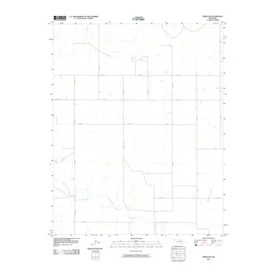
2010 Map of Wheeless
USGS Topo · Published 2010About this map
Corrumpa Creek meanders through the southern portion of this landscape in the Oklahoma Panhandle, carving a natural path across a territory otherwise defined by the rigid geometry of the Public Land Survey System. The map reveals a high-plains environment where transportation is governed by a precise grid of section-line roads, such as N0020 Rd and E0200 Rd. This intersection of natural hydrology and human-imposed order reflects the late-century rural development of Cimarron County, where land use is dictated by the availability of water and the accessibility of these linear thoroughfares. Most of the map is dominated by open ranchland or agricultural fields, punctuated by isolated structures and occasional drainage paths that feed into the larger creek system.
Find a feature on this map
14 named features on this map. Tap any name to fly to it.
Don’t see what you’re looking for? This feature index may not catch every label — zoom into the map to look around manually.
Map Details
Editions of this 2010 Wheeless Map
This is the sole edition of this map. No revisions or reprints were ever made.
Other maps of this area

1954 · Dalhart
USGS Topo · 1:250,000

1958 · Dalhart
USGS Topo · 1:250,000

1962 · Dalhart
USGS Topo · 1:250,000

1969 · Felt SW
USGS Topo · 1:24,000

1969 · Wheeless
USGS Topo · 1:24,000

1969 · Felt
USGS Topo · 1:24,000

1969 · Felt NE
USGS Topo · 1:24,000

1969 · Kenton SE
USGS Topo · 1:24,000
1969 · Kenton SW
USGS Topo · 1:24,000

1972 · Rardin Hill
USGS Topo · 1:24,000