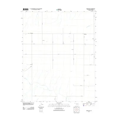
2012 Map of Wheeless
USGS Topo · Published 2012About this map
Mexhoma and Wheeless define the human footprint on this high plains landscape of Cimarron County during the early 21st century. The map reveals a strictly regulated section-line road network, including routes like E0200 Rd and N0020 Rd, that imposes a geometric order over the natural drainage patterns of the Oklahoma Panhandle. This intersection of human planning and geography is most visible where the grid crosses the wandering course of Corrumpa Cr in the south and the intermittent reaches of Cold Springs Cr to the northeast. While the settlements themselves are modest, the density of numbered rural roads suggests a landscape thoroughly partitioned for agricultural and ranching use. The presence of features like E0233 Rd highlights the specific local access points that connect these remote ranching outposts to the wider region.
Find a feature on this map
23 named features on this map. Tap any name to fly to it.
Don’t see what you’re looking for? This feature index may not catch every label — zoom into the map to look around manually.
Map Details
Editions of this 2012 Wheeless Map
This is the sole edition of this map. No revisions or reprints were ever made.
Other maps of this area

1954 · Dalhart
USGS Topo · 1:250,000

1958 · Dalhart
USGS Topo · 1:250,000

1962 · Dalhart
USGS Topo · 1:250,000

1969 · Felt SW
USGS Topo · 1:24,000

1969 · Wheeless
USGS Topo · 1:24,000

1969 · Felt
USGS Topo · 1:24,000

1969 · Felt NE
USGS Topo · 1:24,000

1969 · Kenton SE
USGS Topo · 1:24,000
1969 · Kenton SW
USGS Topo · 1:24,000

1972 · Rardin Hill
USGS Topo · 1:24,000