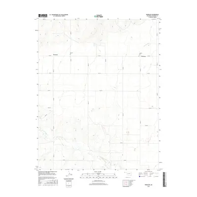
2016 Map of Wheeless
USGS Topo · Published 2016About this map
Mexhoma and Wheeless anchor this high plains landscape in the Oklahoma Panhandle, where the straight lines of the section-road grid meet the meandering paths of intermittent watercourses. The northern portion is defined by the drainage of Cold Springs Cr, while the southern reaches follow the breaks along Corrumpa Cr. This 2016 survey documents a rural environment where community life is centered around local landmarks like the Mexhoma Cem and Wheeless Cem. The density of the road network, including routes like E0200 Rd and N0030 Rd, illustrates the persistent pattern of agricultural land division in Cimarron County. The topography reveals the subtle shifts from flat tablelands into the creek valleys, capturing the specific geography of this borderland region near the corner of Oklahoma.
Find a feature on this map
21 named features on this map. Tap any name to fly to it.
Don’t see what you’re looking for? This feature index may not catch every label — zoom into the map to look around manually.
Map Details
Editions of this 2016 Wheeless Map
This is the sole edition of this map. No revisions or reprints were ever made.
Other maps of this area

1954 · Dalhart
USGS Topo · 1:250,000

1958 · Dalhart
USGS Topo · 1:250,000

1962 · Dalhart
USGS Topo · 1:250,000

1969 · Felt SW
USGS Topo · 1:24,000

1969 · Wheeless
USGS Topo · 1:24,000

1969 · Felt
USGS Topo · 1:24,000

1969 · Felt NE
USGS Topo · 1:24,000

1969 · Kenton SE
USGS Topo · 1:24,000
1969 · Kenton SW
USGS Topo · 1:24,000

1972 · Rardin Hill
USGS Topo · 1:24,000