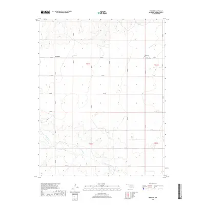
2018 Map of Wheeless
USGS Topo · Published 2018About this map
Mexhoma and Wheeless serve as the primary points of interest in this high-plains landscape in Cimarron County, Oklahoma. The map documents a sparsely settled agricultural region organized by a rigid grid of section roads, including e0200 RD and n0070 RD. For genealogists, the presence of Mexhoma Cem and Wheeless Cem provides essential grounding for family history in the western Panhandle. The terrain is defined by the drainage patterns of Corrumpa Cr in the south and Cold Springs Cr to the northeast, which break the flat topography of the surrounding ranchland. This 2018 survey captures the enduring character of these rural communities, where the infrastructure of the Public Land Survey System remains the dominant feature on the landscape.
Find a feature on this map
25 named features on this map. Tap any name to fly to it.
Don’t see what you’re looking for? This feature index may not catch every label — zoom into the map to look around manually.
Map Details
Editions of this 2018 Wheeless Map
This is the sole edition of this map. No revisions or reprints were ever made.
Other maps of this area

1954 · Dalhart
USGS Topo · 1:250,000

1958 · Dalhart
USGS Topo · 1:250,000

1962 · Dalhart
USGS Topo · 1:250,000

1969 · Felt SW
USGS Topo · 1:24,000

1969 · Wheeless
USGS Topo · 1:24,000

1969 · Felt
USGS Topo · 1:24,000

1969 · Felt NE
USGS Topo · 1:24,000

1969 · Kenton SE
USGS Topo · 1:24,000
1969 · Kenton SW
USGS Topo · 1:24,000

1972 · Rardin Hill
USGS Topo · 1:24,000