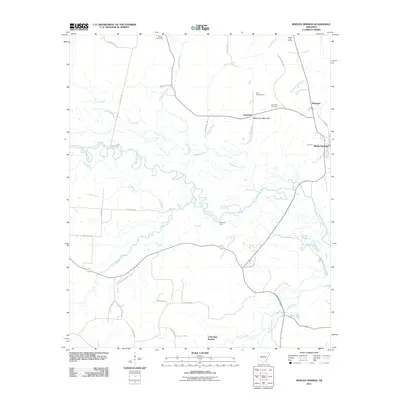
2011 Map of Whelen Springs
USGS Topo · Published 2011About this map
The Little Missouri River meanders across this corner of Clark County, defining a landscape of deep bottomlands and winding tributaries. The river's floodplain is marked by features like Deep Slough and Long Slough, indicating a dynamic hydrology that has shaped local land use for generations. Toward the eastern edge, the settlement of Whelen Springs serves as a focal point, while smaller named locales such as Sycamore, Barringer, and Cummings Springs are dispersed through the surrounding woods and fields.
Find a feature on this map
41 named features on this map. Tap any name to fly to it.
Don’t see what you’re looking for? This feature index may not catch every label — zoom into the map to look around manually.
Map Details
Editions of this 2011 Whelen Springs Map
This is the sole edition of this map. No revisions or reprints were ever made.
Other maps of this area

1901 · Gurdon
USGS Topo · 1:125,000

1953 · El Dorado
USGS Topo · 1:250,000

1957 · El Dorado
USGS Topo · 1:250,000

1958 · El Dorado
USGS Topo · 1:250,000

1960 · El Dorado
USGS Topo · 1:250,000

1970 · Whelen Springs
USGS Topo · 1:24,000

1970 · Prescott East
USGS Topo · 1:24,000

1970 · Reader
USGS Topo · 1:24,000
1970 · Gurdon
USGS Topo · 1:24,000
1970 · Curtis
USGS Topo · 1:24,000