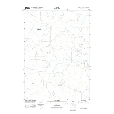
2012 Map of Whipple Hollow
USGS Topo · Published 2012About this map
Vollman Ranch stands as a central landmark in this high-plains landscape of Converse County, where the terrain is defined by broad plateaus and winding drainage systems. The topography is shaped by the Box Creek Divide, which separates the seasonal watercourses flowing through the area. Several distinct flatlands, including Highland Flats and Taylor Flats, illustrate the open character of the Wyoming ranching country.
Find a feature on this map
11 named features on this map. Tap any name to fly to it.
Don’t see what you’re looking for? This feature index may not catch every label — zoom into the map to look around manually.
Map Details
Editions of this 2012 Whipple Hollow Map
This is the sole edition of this map. No revisions or reprints were ever made.
Other maps of this area

1949 · Sundquist Ranch
USGS Topo · 1:24,000

1949 · Gilbert Lake
USGS Topo · 1:24,000

1949 · Leuenberger Ranch
USGS Topo · 1:24,000

1950 · Gilbert Lake
USGS Topo · 1:24,000

1950 · Leuenberger Ranch
USGS Topo · 1:24,000
1950 · Sundquist Ranch
USGS Topo · 1:24,000

1954 · Torrington
USGS Topo · 1:250,000

1955 · Newcastle
USGS Topo · 1:250,000

1958 · Torrington
USGS Topo · 1:250,000

1958 · Newcastle
USGS Topo · 1:250,000