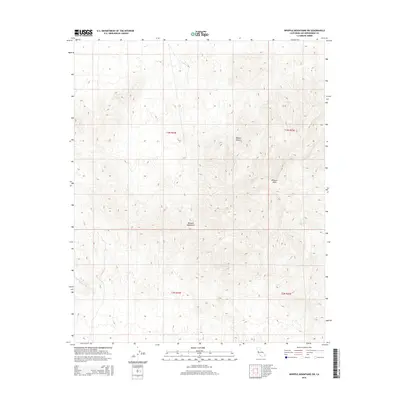
2015 Map of Whipple Mountains SW
USGS Topo · Published 2015About this map
The Whipple Mountains dominate this arid landscape within the eastern Mojave Desert, revealing a complex network of canyons and high ridges in San Bernardino County. A central drainage feature, Whipple Wash, cuts through the rugged topography, serving as the primary hydrological artery for the surrounding terrain. This survey provides a clear view of the Public Land Survey System grid, including t3n r24e, t3n r25e, t2n r24e, and t2n r25e, which organize the uninhabited reaches of this mountain range. The terrain is characterized by steep elevation changes and intricate dry wash systems, illustrating the desert's geomorphology before any significant modern development or infrastructure modified these protected lands.
Find a feature on this map
7 named features on this map. Tap any name to fly to it.
Don’t see what you’re looking for? This feature index may not catch every label — zoom into the map to look around manually.
Map Details
Editions of this 2015 Whipple Mountains SW Map
This is the sole edition of this map. No revisions or reprints were ever made.
Other maps of this area

1911 · Parker
USGS Topo · 1:125,000

1943 · Whipple Mts.
USGS Topo · 1:62,500

1943 · Parker
USGS Topo · 1:62,500

1943 · Vidal
USGS Topo · 1:62,500

1949 · Parker
USGS Topo · 1:62,500

1949 · Vidal
USGS Topo · 1:62,500

1950 · Parker
USGS Topo · 1:62,500

1950 · Vidal
USGS Topo · 1:62,500

1950 · Whipple Mts
USGS Topo · 1:62,500

1950 · Savahia Peak
USGS Topo · 1:62,500