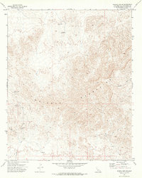
1970 Map of Whipple Mts SW
USGS Topo · Published 1973About this map
The Whipple Mountains dominate this 1970 desert landscape, where the extraction of mineral wealth defines the scattered infrastructure. Mining operations such as the War Eagle No 1 Mine and American Eagle Mine are connected by a network of unimproved routes, including the Chambers Well Road and various sections of Jeep Trail. The presence of Leaching Tanks near several unnamed Mines in the southeast indicates active or recent chemical processing of ore, a common practice for recovering precious metals in arid environments. Water management in this parched terrain is evidenced by sites like Whipple Well (Dry) and Chambers Well (Dry), which, despite their names, appear to have been unreliable or exhausted by the time of the 1969 aerial survey. The primary drainage, Whipple Wash, cuts through the mountain range, providing a natural corridor for movement through the steep contours.
Find a feature on this map
18 named features on this map. Tap any name to fly to it.
Don’t see what you’re looking for? This feature index may not catch every label — zoom into the map to look around manually.
Map Details
Editions of this 1970 Whipple Mts SW Map
This is the sole edition of this map. No revisions or reprints were ever made.
Other maps of this area

1911 · Parker
USGS Topo · 1:125,000

1943 · Whipple Mts.
USGS Topo · 1:62,500

1943 · Parker
USGS Topo · 1:62,500

1943 · Vidal
USGS Topo · 1:62,500

1949 · Parker
USGS Topo · 1:62,500

1949 · Vidal
USGS Topo · 1:62,500

1950 · Parker
USGS Topo · 1:62,500

1950 · Vidal
USGS Topo · 1:62,500

1950 · Whipple Mts
USGS Topo · 1:62,500

1950 · Savahia Peak
USGS Topo · 1:62,500