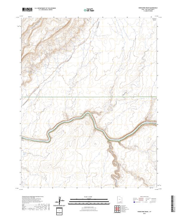
2023 Map of Whirlwind Draw
USGS Topo · Published 2023About this map
The San Juan River carves a deep path through this remote portion of San Juan County, winding its way through the San Juan Valley and the vast Glen Canyon National Recreation Area. The landscape is defined by dramatic elevation changes, where the Clay Hills and the striking Red House Cliffs overlook the river corridor. This modern survey illustrates how traditional crossings and rugged access routes like the Clay Hills Crossing Road and the Whirlwind Crossing Rd continue to traverse the terrain, following historical paths through the Red Rock Plateau. Notable water features like Nancys Pool and the ephemeral Whirlwind Draw highlight the scarce but critical hydrologic points in this high desert environment, while the confluence of Oljato Wash from the south demonstrates the complex drainage network feeding the main river channel.
Find a feature on this map
14 named features on this map. Tap any name to fly to it.
Don’t see what you’re looking for? This feature index may not catch every label — zoom into the map to look around manually.
Map Details
Editions of this 2023 Whirlwind Draw Map
This is the sole edition of this map. No revisions or reprints were ever made.
Other maps of this area

1886 · Henry Mountains
USGS Topo · 1:250,000

1892 · Henry Mountains
USGS Topo · 1:250,000

1952 · Clay Hills 3 NW
USGS Topo · 1:24,000

1952 · Oljeto
USGS Topo · 1:62,500

1954 · Clay Hills 2 SW
USGS Topo · 1:24,000

1954 · Clay Hills 2 NW
USGS Topo · 1:24,000
1954 · Clay Hills 3 NE
USGS Topo · 1:24,000

1954 · Clay Hills 2 NE
USGS Topo · 1:24,000

1954 · Clay Hills 2 SE
USGS Topo · 1:24,000

1954 · Clay Hills 1 NW
USGS Topo · 1:24,000