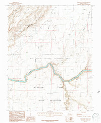
1987 Map of Whirlwind Draw
USGS Topo · Published 1987About this map
Lake Powell and the winding San Juan River dominate this landscape, illustrating the intersection of federal recreation land and tribal territory in the late 1980s. To the south, the Monument Valley Navajo Indian Reservation borders the river, while the northern banks are managed as the Glen Canyon National Recreation Area. The topography is defined by the sharp verticality of the Red House Cliffs and the northern Clay Hills, where numerous drainages like Whirlwind Draw and Steer Gulch carve through the high desert toward the river valley. Notable landmarks such as Nancys Pool and the Oljeto Wash provide specific points of interest for researchers studying the geographic layout of San Juan County before contemporary development. This provisional survey captures the raw state of the canyon lands, highlighting the natural barriers and water sources that dictated the use of this territory.
Find a feature on this map
11 named features on this map. Tap any name to fly to it.
Don’t see what you’re looking for? This feature index may not catch every label — zoom into the map to look around manually.
Map Details
Editions of this 1987 Whirlwind Draw Map
This is the sole edition of this map. No revisions or reprints were ever made.
Other maps of this area

1886 · Henry Mountains
USGS Topo · 1:250,000

1892 · Henry Mountains
USGS Topo · 1:250,000

1952 · Clay Hills 3 NW
USGS Topo · 1:24,000

1952 · Oljeto
USGS Topo · 1:62,500

1954 · Clay Hills 2 SW
USGS Topo · 1:24,000

1954 · Clay Hills 2 NW
USGS Topo · 1:24,000
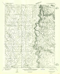
1954 · Clay Hills 3 NE
USGS Topo · 1:24,000

1954 · Clay Hills 2 NE
USGS Topo · 1:24,000

1954 · Clay Hills 2 SE
USGS Topo · 1:24,000

1954 · Clay Hills 1 NW
USGS Topo · 1:24,000