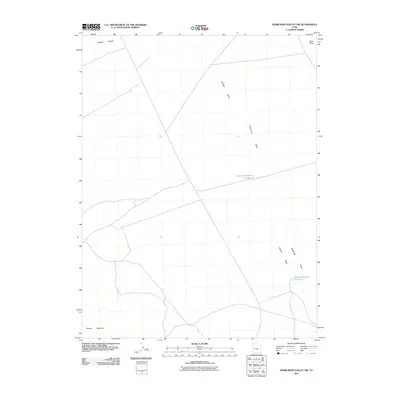
2011 Map of Whirlwind Valley NW
USGS Topo · Published 2011About this map
Whirlwind Valley and the surrounding high desert of Millard County are defined by a network of drainage channels and remote water catchments. The landscape is dominated by the broad Swasey Bottom and the rugged slopes of Swasey Mountain, with drainage features such as Swasey Wash cutting through the arid terrain. Human activity in this remote region is marked by livestock water infrastructure, specifically Swasey Reservoir Number 2 and Swasey Reservoir Number 3. These features reflect the long-standing importance of water management in the Great Basin. The prominence of Black Point provides a clear geographical marker in this expansive territory, while the map's network of local roads and 4WD tracks indicates the primary routes used by ranchers and land managers navigating the valley floor and foothills in the early 21st century.
Find a feature on this map
7 named features on this map. Tap any name to fly to it.
Don’t see what you’re looking for? This feature index may not catch every label — zoom into the map to look around manually.
Map Details
Editions of this 2011 Whirlwind Valley NW Map
This is the sole edition of this map. No revisions or reprints were ever made.
Other maps of this area

1908 · Fish Springs
USGS Topo · 1:250,000

1910 · Fish Springs
USGS Topo · 1:250,000

1953 · Topaz Mtn
USGS Topo · 1:62,500

1953 · Delta
USGS Topo · 1:250,000

1958 · Delta
USGS Topo · 1:250,000

1962 · Delta
USGS Topo · 1:250,000

1967 · Sand Pass SE
USGS Topo · 1:24,000

1972 · Whirlwind Valley SW
USGS Topo · 1:24,000
1972 · Swasey Peak
USGS Topo · 1:24,000
1972 · Little Drum Pass
USGS Topo · 1:24,000