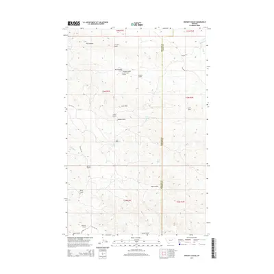
2014 Map of Whiskey Coulee
USGS Topo · Published 2014About this map
Larb Hills anchor this high-plains landscape in northern Montana, where the boundary between Phillips and Valley counties follows the local section lines. This 2014 survey reveals an intricate network of drainage features known as coulees, which define the movement of water across the semi-arid terrain. Named formations like The Chimneys, Castle Rocks, and Castle Butte provide distinct navigational markers for those traveling through the open range.
Find a feature on this map
34 named features on this map. Tap any name to fly to it.
Don’t see what you’re looking for? This feature index may not catch every label — zoom into the map to look around manually.
Map Details
Editions of this 2014 Whiskey Coulee Map
This is the sole edition of this map. No revisions or reprints were ever made.
Other maps of this area

1954 · Jordan
USGS Topo · 1:250,000

1956 · Jordan
USGS Topo · 1:250,000

1958 · Jordan
USGS Topo · 1:250,000

1964 · Jordan
USGS Topo · 1:250,000

1965 · Coal Mine Hill
USGS Topo · 1:24,000

1965 · Schuyler Butte
USGS Topo · 1:24,000

1965 · Buckley Lake
USGS Topo · 1:24,000

1971 · Wolfe Coulee
USGS Topo · 1:24,000
1971 · Swede Ridge
USGS Topo · 1:24,000

1973 · Niles Coulee
USGS Topo · 1:24,000