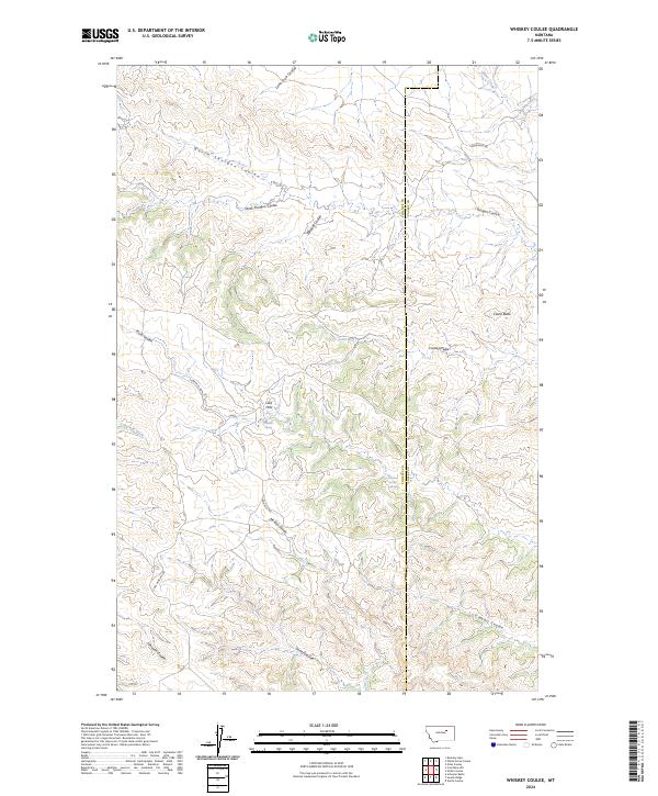
2024 Map of Whiskey Coulee
USGS Topo · Published 2024About this map
The Phillips and Valley County line cuts vertically through this high plains landscape, a terrain defined by the complex drainage systems of the Larb Hills. The map shows a region of deep coulees and intermittent water sources, where names like Whiskey Coulee and North Shotgun Coulee reflect the local geography of the Missouri River breaks. Settlement is sparse, represented primarily by vital water points such as School Section Spring, Chandler Spring, and Fratiks Spring. These springs provided essential resources for the ranching operations that have long characterized this portion of North Central Montana. High points like Castle Butte provide clear landmarks above the intersecting draws of Castle Coulee and Plum Coulee. Transportation is limited to a few rugged routes, including Larb Hills Rd and the descriptively named Coal Mine Hill Rd, which hint at the region's historic land use and small-scale resource extraction.
Find a feature on this map
29 named features on this map. Tap any name to fly to it.
Don’t see what you’re looking for? This feature index may not catch every label — zoom into the map to look around manually.
Map Details
Editions of this 2024 Whiskey Coulee Map
This is the sole edition of this map. No revisions or reprints were ever made.
Other maps of this area

1954 · Jordan
USGS Topo · 1:250,000

1956 · Jordan
USGS Topo · 1:250,000

1958 · Jordan
USGS Topo · 1:250,000

1964 · Jordan
USGS Topo · 1:250,000

1965 · Coal Mine Hill
USGS Topo · 1:24,000

1965 · Schuyler Butte
USGS Topo · 1:24,000

1965 · Buckley Lake
USGS Topo · 1:24,000

1971 · Wolfe Coulee
USGS Topo · 1:24,000
1971 · Swede Ridge
USGS Topo · 1:24,000

1973 · Niles Coulee
USGS Topo · 1:24,000