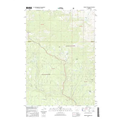
2017 Map of Whiskey Mountain
USGS Topo · Published 2017About this map
Whiskey Mountain and Snow Mtn anchor this high-elevation landscape along the boundary of the Malheur National Forest and Ochoco National Forest. The map documents a rugged interior network of Forest Service development roads, such as Nat For Dev RD 43 and Snow Mountain Rd, which provide access to a terrain defined more by its water sources than by permanent settlements. Numerous named springs, including Schoolman Spring, Ben Brown Spring, and Lethas Spring, suggest a history of seasonal range use and watershed management. The presence of Whiskey Flat and Sawtooth Meadows indicates significant high-country grazing lands, while Officers Reservoir in the northeast corner serves as a critical point of water collection. This 2017 survey reflects the modern management of these protected public lands, detailing the specific topography and hydrography at the intersection of Grant and Harney Counties.
Find a feature on this map
51 named features on this map. Tap any name to fly to it.
Don’t see what you’re looking for? This feature index may not catch every label — zoom into the map to look around manually.
Map Details
Editions of this 2017 Whiskey Mountain Map
This is the sole edition of this map. No revisions or reprints were ever made.
Other maps of this area

1932 · Dayville
USGS Topo · 1:125,000

1936 · Dayville
USGS Topo · 1:125,000

1955 · Burns
USGS Topo · 1:250,000

1955 · Canyon City
USGS Topo · 1:250,000

1958 · Burns
USGS Topo · 1:250,000

1959 · Burns
USGS Topo · 1:250,000

1959 · Canyon City
USGS Topo · 1:250,000

1959 · Sawtooth Creek
USGS Topo · 1:62,500

1961 · Delintment Lake
USGS Topo · 1:62,500

1961 · Izee
USGS Topo · 1:62,500