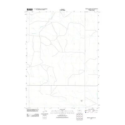
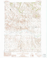
2011 Map of Whistle Creek SE
USGS Topo · Published 2011About this map
Whistle Creek winds through this rural Sioux County landscape, defining the hydrology of an area primarily dedicated to cattle ranching and large-scale agriculture. The terrain is marked by a network of sectional roads and drainage patterns typical of the Nebraska panhandle. A distinctive landmark in this sparsely populated region is the Plainsview Ranch Airport, a private airstrip that underscores the vast distances and transportation needs of remote Western Nebraska ranching operations. In the southeastern corner, the North Branch Snake Creek flows through the grasslands, while significant thoroughfares like Morrill Rd and Wheeler Rd provide the essential terrestrial links between distant homesteads and the regional cattle economy.
Find a feature on this map
5 named features on this map. Tap any name to fly to it.
Don’t see what you’re looking for? This feature index may not catch every label — zoom into the map to look around manually.
Map Details
Editions of this 2011 Whistle Creek SE Map
This is the sole edition of this map. No revisions or reprints were ever made.
Other maps of this area

1899 · Whistle Creek
USGS Topo · 1:125,000

1951 · Marsland
USGS Topo · 1:62,500

1951 · Kilpatrick Lake
USGS Topo · 1:62,500

1955 · Alliance
USGS Topo · 1:250,000

1957 · Alliance
USGS Topo · 1:250,000

1958 · Alliance
USGS Topo · 1:250,000
1983 · Kilpatrick Lake NW
USGS Topo · 1:24,000
1983 · Marsland SW
USGS Topo · 1:24,000
1983 · University Lake NW
USGS Topo · 1:24,000
1983 · Marsland NW
USGS Topo · 1:24,000