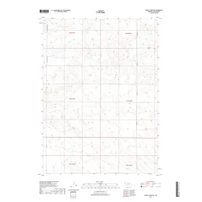
2017 Map of Whistle Creek SE
USGS Topo · Published 2017About this map
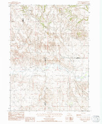
Whistle Cr meanders through the northwest corner of this Sioux County landscape, defining the drainage patterns of a region predominantly shaped by the High Plains topography of western Nebraska. The map details a systematic grid of township boundaries, including t28n r54w and t27n r53w, which reflect the historical Public Land Survey System division of the territory. Transportation in this section of the panhandle relies on a sparse network of section-line roads, such as Pink School House Rd and Wheeler Rd, which provide access across the high prairie. In the southeastern reaches, the N Br Snake Cr begins its descent, illustrating the subtle divide between the regional watersheds. This 2017 survey documents the modern ranching and agricultural land divisions while preserving the local names assigned to its primitive routes and seasonal waterways.
Find a feature on this map
12 named features on this map. Tap any name to fly to it.
Don’t see what you’re looking for? This feature index may not catch every label — zoom into the map to look around manually.
Map Details
Editions of this 2017 Whistle Creek SE Map
This is the sole edition of this map. No revisions or reprints were ever made.
Other maps of this area

1899 · Whistle Creek
USGS Topo · 1:125,000

1951 · Marsland
USGS Topo · 1:62,500

1951 · Kilpatrick Lake
USGS Topo · 1:62,500

1955 · Alliance
USGS Topo · 1:250,000

1957 · Alliance
USGS Topo · 1:250,000

1958 · Alliance
USGS Topo · 1:250,000
1983 · Kilpatrick Lake NW
USGS Topo · 1:24,000
1983 · Marsland SW
USGS Topo · 1:24,000
1983 · University Lake NW
USGS Topo · 1:24,000
1983 · Marsland NW
USGS Topo · 1:24,000