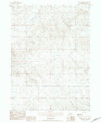
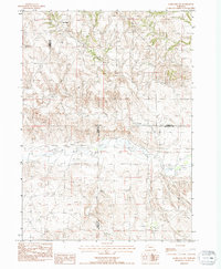
1983 Map of Whistle Creek SE
USGS Topo · Published 1984About this map
Whistle Creek and the surrounding drainage of North Branch Snake Cr define the topography of this corner of Sioux County. This 1980s-era provisional map captures a transition toward modern land use while retaining isolated markers of early settlement and pastoral life. Deeply etched draws and ridge lines are punctuated by occasional rural landmarks, including the lone Curly Sch and a single Grave located south of the creek bed. The presence of several Irr Well sites suggests the importance of groundwater for the region's agricultural viability during this period. To the west, Coyote Springs provides a natural water source, contrasting with the man-made infrastructure of the Trans Steel Tower power line corridor that traverses the northern sections.
Find a feature on this map
9 named features on this map. Tap any name to fly to it.
Don’t see what you’re looking for? This feature index may not catch every label — zoom into the map to look around manually.
Map Details
Editions of this 1983 Whistle Creek SE Map
This is the sole edition of this map. No revisions or reprints were ever made.
Other maps of this area

1899 · Whistle Creek
USGS Topo · 1:125,000

1951 · Marsland
USGS Topo · 1:62,500

1951 · Kilpatrick Lake
USGS Topo · 1:62,500

1955 · Alliance
USGS Topo · 1:250,000

1957 · Alliance
USGS Topo · 1:250,000

1958 · Alliance
USGS Topo · 1:250,000
1983 · Kilpatrick Lake NW
USGS Topo · 1:24,000
1983 · Marsland SW
USGS Topo · 1:24,000
1983 · University Lake NW
USGS Topo · 1:24,000
1983 · Marsland NW
USGS Topo · 1:24,000