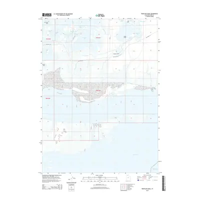
2014 Map of Whistler Canal
USGS Topo · Published 2014About this map
Bear River dominates the northern landscape of this region in Box Elder County, as it winds through a complex network of bays and overflows before reaching the expansive waters of Willard Bay. The geography is defined by a delicate balance of land and water, featuring named points such as Fish Fossil Rocks, Pintail Neck, and The Knoll. The extensive irrigation and drainage infrastructure, including the Whistler Canal, East Lateral, and West Lateral, illustrates the mid-century management of this marshy terrain. Local landmarks like Whistlers Bend and Goose Island provide specific reference points for researchers studying the historical hydrology and land use along the Bird Refuge Rd corridor, where the river meets the Willard Bay Reservoir.
Find a feature on this map
30 named features on this map. Tap any name to fly to it.
Don’t see what you’re looking for? This feature index may not catch every label — zoom into the map to look around manually.
Map Details
Editions of this 2014 Whistler Canal Map
This is the sole edition of this map. No revisions or reprints were ever made.
Other maps of this area

1954 · Whistler Canal
USGS Topo · 1:24,000

1954 · Public Shooting Grounds
USGS Topo · 1:24,000

1954 · Brigham City
USGS Topo · 1:250,000

1955 · Plain City
USGS Topo · 1:24,000

1955 · Willard Spur
USGS Topo · 1:24,000

1955 · Mouth of Bear River
USGS Topo · 1:24,000

1955 · Plain City SW
USGS Topo · 1:24,000

1955 · Bear River City
USGS Topo · 1:24,000

1955 · Willard
USGS Topo · 1:24,000

1955 · Brigham City
USGS Topo · 1:24,000