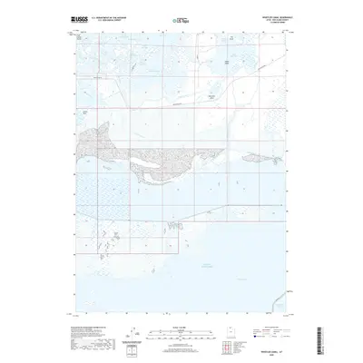
2020 Map of Whistler Canal
USGS Topo · Published 2020About this map
The northern reaches of the Great Salt Lake define this 2020 landscape, where the delta of the Bear River meets complex marshlands and managed waterways. In this corner of Box Elder County, the river winds toward Whistlers Bend and passes Goose Island before dispersing into a series of named inlets including East Bay, Little Bear Bay, and Stanley McGraw Bay. The map highlights the sophisticated hydraulic network that supports the region, including the Whistler Canal, West Lateral, and East Lateral, which manage water flow across the low-lying terrain. To the south, the massive expanse of Willard Bay is contained behind the Dike Rd, illustrating the modern management of the Great Salt Lake ecosystem. Distinctive natural landmarks such as Fish Rocks, The Knoll, and Pintail Neck rise above the surrounding wetlands and overflow areas.
Find a feature on this map
24 named features on this map. Tap any name to fly to it.
Don’t see what you’re looking for? This feature index may not catch every label — zoom into the map to look around manually.
Map Details
Editions of this 2020 Whistler Canal Map
This is the sole edition of this map. No revisions or reprints were ever made.
Other maps of this area

1954 · Whistler Canal
USGS Topo · 1:24,000

1954 · Public Shooting Grounds
USGS Topo · 1:24,000

1954 · Brigham City
USGS Topo · 1:250,000

1955 · Plain City
USGS Topo · 1:24,000

1955 · Willard Spur
USGS Topo · 1:24,000

1955 · Mouth of Bear River
USGS Topo · 1:24,000

1955 · Plain City SW
USGS Topo · 1:24,000

1955 · Bear River City
USGS Topo · 1:24,000

1955 · Willard
USGS Topo · 1:24,000

1955 · Brigham City
USGS Topo · 1:24,000