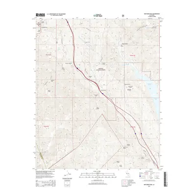
2015 Map of Whitaker Peak
USGS Topo · Published 2015About this map
Whitaker Peak rises as a central landmark within the high terrain of the Angeles National Forest, where steep canyons and narrow ridges define the landscape of northern Los Angeles County. The map details the modern path of the Golden State Hwy as it cuts through the mountains, passing through high points like Whitaker Summit and Violin Summit. A significant engineering feat is visible in the subterranean path of the Angeles Tunnel, part of the Governor Edmund G Brown W. Br. California Aqueduct, which moves water through the range toward Castaic Lake and the Elderberry Forebay. Small, isolated locales like Frenchmans Flat, Naylor Place, and Martins are scattered among the deep drainages of Canton Canyon and Fish Canyon, illustrating the sparse but vital human footprint in this protected forest area during the early 21st century.
Find a feature on this map
50 named features on this map. Tap any name to fly to it.
Don’t see what you’re looking for? This feature index may not catch every label — zoom into the map to look around manually.
Map Details
Editions of this 2015 Whitaker Peak Map
This is the sole edition of this map. No revisions or reprints were ever made.
Other maps of this area

1900 · Piru
USGS Topo · 1:62,500

1903 · Tejon
USGS Topo · 1:125,000

1903 · Camulos
USGS Topo · 1:125,000

1903 · Santa Susana
USGS Topo · 1:62,500

1921 · Piru
USGS Topo · 1:62,500

1931 · Whitaker Peak
USGS Topo · 1:24,000

1931 · Santa Felicia Canyon
USGS Topo · 1:24,000

1931 · Castaic
USGS Topo · 1:24,000

1931 · Redrock Mtn
USGS Topo · 1:24,000

1932 · Beartrap Canyon
USGS Topo · 1:24,000