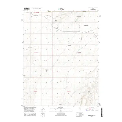
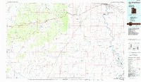
2014 Map of Whitbeck Knoll
USGS Topo · Published 2014About this map
Whitbeck Knoll and Sheep Knoll dominate this 2014 survey of the high desert along the border of Emery and Wayne counties. The landscape is defined by a network of drainage systems and isolated water sources, including Village Home Spring, Hooch Spring, and Buffalo Pond, which provided critical relief in the arid San Rafael Desert. This era shows a territory managed for both resource extraction and backcountry access, with routes such as Oil Well Rd and N Roost Rd cutting through the terrain.
Find a feature on this map
27 named features on this map. Tap any name to fly to it.
Don’t see what you’re looking for? This feature index may not catch every label — zoom into the map to look around manually.
Map Details
Editions of this 2014 Whitbeck Knoll Map
This is the sole edition of this map. No revisions or reprints were ever made.
Other maps of this area

1885 · San Rafael
USGS Topo · 1:250,000

1953 · The Spur
USGS Topo · 1:62,500

1956 · Salina
USGS Topo · 1:250,000

1960 · Salina
USGS Topo · 1:250,000

1962 · Salina
USGS Topo · 1:250,000

1963 · Robbers Roost Canyon
USGS Topo · 1:62,500
1963 · Bowknot Bend
USGS Topo · 1:62,500
1963 · The Flat Tops
USGS Topo · 1:62,500
1980 · Hanksville
USGS Topo · 1:100,000
1985 · San Rafael Desert
USGS Topo · 1:100,000