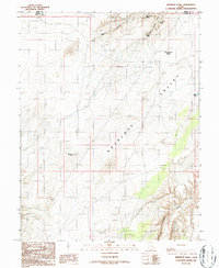
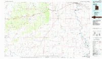
1986 Map of Whitbeck Knoll
USGS Topo · Published 1987About this map
Whitbeck Knoll and the broad expanse of Antelope Valley characterize this high-desert landscape along the boundary of Wayne and Emery counties. Based on field checks conducted in the mid-1980s, this provisional survey documents a region defined by its water sources and drainage systems, including Bluejohn Canyon and several isolated springs like Village Home Spring and Hooch Spring. The terrain transitions from the shifting Sand Dunes in the north to the distinctive depression of Little Saucer Basin.
Find a feature on this map
15 named features on this map. Tap any name to fly to it.
Don’t see what you’re looking for? This feature index may not catch every label — zoom into the map to look around manually.
Map Details
Editions of this 1986 Whitbeck Knoll Map
This is the sole edition of this map. No revisions or reprints were ever made.
Other maps of this area

1885 · San Rafael
USGS Topo · 1:250,000

1953 · The Spur
USGS Topo · 1:62,500

1956 · Salina
USGS Topo · 1:250,000

1960 · Salina
USGS Topo · 1:250,000

1962 · Salina
USGS Topo · 1:250,000

1963 · Robbers Roost Canyon
USGS Topo · 1:62,500
1963 · Bowknot Bend
USGS Topo · 1:62,500
1963 · The Flat Tops
USGS Topo · 1:62,500
1980 · Hanksville
USGS Topo · 1:100,000
1985 · San Rafael Desert
USGS Topo · 1:100,000