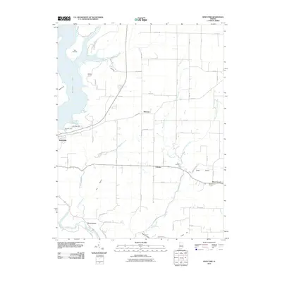
2010 Map of Whitcomb
USGS Topo · Published 2010About this map
Brookville Lake dominates the western edge of this Franklin County landscape, its creation having fundamentally altered the topography between Brookville and the northern reaches of the quadrangle. The Brookville Lake Dam anchors the southern end of the reservoir, while recreation and conservation points like Orschell Overlook and Battle Point now define the shoreline near The Mounds. East of the water, the terrain is characterized by a series of high points and drainages, including Garr Hill and Cobbs Hill, and the significant valleys of Little Cedar Creek and Big Cedar Creek.
Find a feature on this map
61 named features on this map. Tap any name to fly to it.
Don’t see what you’re looking for? This feature index may not catch every label — zoom into the map to look around manually.
Map Details
Editions of this 2010 Whitcomb Map
This is the sole edition of this map. No revisions or reprints were ever made.
Other maps of this area

1915 · College Corner
USGS Topo · 1:48,000

1915 · Harrison
USGS Topo · 1:48,000

1918 · College Corner
USGS Topo · 1:62,500

1948 · Fairfield
USGS Topo · 1:24,000

1953 · Cincinnati
USGS Topo · 1:250,000

1955 · Harrison
USGS Topo · 1:24,000

1955 · Reily
USGS Topo · 1:24,000

1955 · Mount Carmel
USGS Topo · 1:24,000
1955 · Cedar Grove
USGS Topo · 1:24,000

1956 · Everton
USGS Topo · 1:24,000