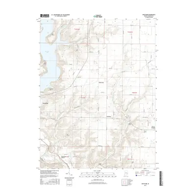
2016 Map of Whitcomb
USGS Topo · Published 2016About this map
Brookville Lake dominates the northwestern landscape of this modern survey, its waters meeting the steep elevations of The Mounds and Battle Point. This corner of Franklin County preserves a network of named heights and hollows, including Garr Hill, Bon Well Hill, and Owl Hollow, illustrating the deeply dissected topography typical of the region's river valleys. The settlement of Whitcomb sits centrally at a junction of rural roads like Oxford Pike and Whitcomb Rd, while Palestine and Sleepy Hollow lie further south. Genealogists can locate family resting places at James Cem and Mount Carmel Cem. The drainage patterns are clearly defined by Little Cedar Cr and the Whitewater River, tracing the natural corridors that have shaped local transport and agriculture for generations.
Find a feature on this map
70 named features on this map. Tap any name to fly to it.
Don’t see what you’re looking for? This feature index may not catch every label — zoom into the map to look around manually.
Map Details
Editions of this 2016 Whitcomb Map
This is the sole edition of this map. No revisions or reprints were ever made.
Other maps of this area

1915 · College Corner
USGS Topo · 1:48,000

1915 · Harrison
USGS Topo · 1:48,000

1918 · College Corner
USGS Topo · 1:62,500

1948 · Fairfield
USGS Topo · 1:24,000

1953 · Cincinnati
USGS Topo · 1:250,000

1955 · Harrison
USGS Topo · 1:24,000

1955 · Reily
USGS Topo · 1:24,000

1955 · Mount Carmel
USGS Topo · 1:24,000
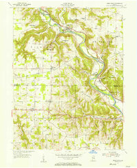
1955 · Cedar Grove
USGS Topo · 1:24,000

1956 · Everton
USGS Topo · 1:24,000