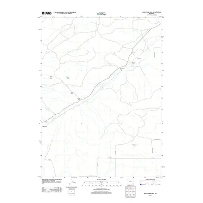
2012 Map of Whitcomb Hill
USGS Topo · Published 2012About this map
Chugwater Cr flows through the center of this Laramie County landscape, carving a valley that has historically served as a primary corridor for ranching and transportation. The drainage system is complex, fed by several significant watercourses including N Chugwater Cr and S Richeau Cr. The ranching heritage of the region is evident in the presence of established operations such as the Whitcomb Ranch and Foss Ranch, alongside the community at Diamond. Local topography is defined by distinctive high points and drainage features like Degans Butte and Whitcomb Hill. The map illustrates the 2012 road network, showing how local routes such as Gillaspie Rd and Blue Rock Rd connect these remote ranching outposts across the breaks and draws.
Find a feature on this map
23 named features on this map. Tap any name to fly to it.
Don’t see what you’re looking for? This feature index may not catch every label — zoom into the map to look around manually.
Map Details
Editions of this 2012 Whitcomb Hill Map
This is the sole edition of this map. No revisions or reprints were ever made.
Other maps of this area

1953 · Double L Ranch
USGS Topo · 1:24,000

1953 · Chugwater
USGS Topo · 1:24,000

1953 · Richeau Hills
USGS Topo · 1:24,000

1954 · Cheyenne
USGS Topo · 1:250,000

1958 · Cheyenne
USGS Topo · 1:250,000

1962 · Moffett Ranch
USGS Topo · 1:24,000

1962 · Bristol Ridge
USGS Topo · 1:24,000

1962 · Hirsig Ranch
USGS Topo · 1:24,000

1962 · Mc Donald Ranch
USGS Topo · 1:24,000

1962 · Bristol Ridge NE
USGS Topo · 1:24,000