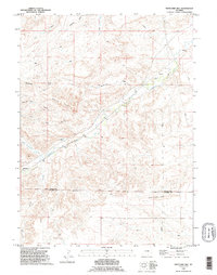
1990 Map of Whitcomb Hill
USGS Topo · Published 1995About this map
Whitcomb Hill anchors this high-plains landscape along the border of Platte and Laramie Counties, where a network of established ranching operations defines the local geography. The map reveals a cluster of family-named holdings, including the Whitcomb Ranch, McDonald Ranch, and Double L Ranch, reflecting the area's deep-rooted cattle and agriculture heritage. The settlement of Brinton sits near the northeastern corner, positioned where Chugwater Creek flows through the drainages of the high plateau.
Find a feature on this map
23 named features on this map. Tap any name to fly to it.
Don’t see what you’re looking for? This feature index may not catch every label — zoom into the map to look around manually.
Map Details
Editions of this 1990 Whitcomb Hill Map
This is the sole edition of this map. No revisions or reprints were ever made.
Other maps of this area

1953 · Double L Ranch
USGS Topo · 1:24,000

1953 · Chugwater
USGS Topo · 1:24,000

1953 · Richeau Hills
USGS Topo · 1:24,000

1954 · Cheyenne
USGS Topo · 1:250,000

1958 · Cheyenne
USGS Topo · 1:250,000

1962 · Moffett Ranch
USGS Topo · 1:24,000

1962 · Bristol Ridge
USGS Topo · 1:24,000

1962 · Hirsig Ranch
USGS Topo · 1:24,000

1962 · Mc Donald Ranch
USGS Topo · 1:24,000

1962 · Bristol Ridge NE
USGS Topo · 1:24,000