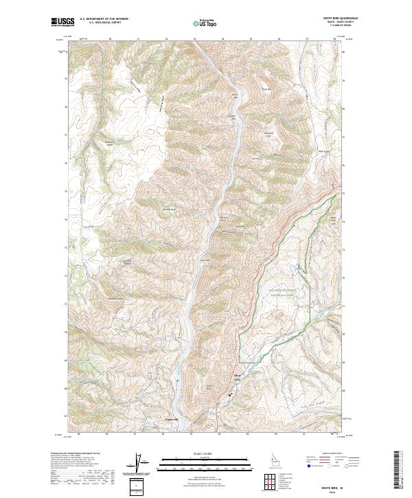
2024 Map of White Bird
USGS Topo · Published 2024About this map
The Salmon River carves a deep, winding course through this part of Idaho County, defining a landscape of high ridges and narrow river bars. The settlement of White Bird sits near the confluence of White Bird Creek and the river, serving as a focal point for the surrounding canyon lands. This terrain is characterized by dramatic elevation changes, moving from the river banks at Shorts Bar and Lyons Bar up to the expansive Doumecq Plains and the prominent White Bird Hill.
Find a feature on this map
80 named features on this map. Tap any name to fly to it.
Don’t see what you’re looking for? This feature index may not catch every label — zoom into the map to look around manually.
Map Details
Editions of this 2024 White Bird Map
This is the sole edition of this map. No revisions or reprints were ever made.
Other maps of this area

1955 · Grangeville
USGS Topo · 1:250,000

1959 · Grangeville
USGS Topo · 1:250,000

1963 · McKinzie Creek
USGS Topo · 1:24,000

1963 · Grangeville West
USGS Topo · 1:24,000

1963 · White Bird Hill
USGS Topo · 1:24,000

1963 · Slate Creek
USGS Topo · 1:24,000

1963 · Moughmer Point
USGS Topo · 1:24,000

1963 · Joseph
USGS Topo · 1:24,000

1963 · Grave Point
USGS Topo · 1:24,000

1963 · White Bird
USGS Topo · 1:24,000