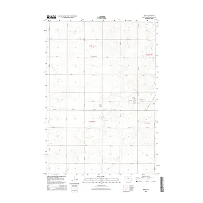
2015 Map of White
USGS Topo · Published 2015About this map
White sits prominently on the eastern edge of the Coteau des Prairies, a vast upland plateau that shapes the landscape of Brookings County. This 2015 survey details the grid of the town, centered around W Main St and E Main St, with a local Po serving as a community anchor. The surrounding terrain is defined by the winding course of Sixmile Cr, which meanders across the section lines of the Public Land Survey System, including t112n r49w and t111n r48w. Local heritage is anchored by two burial grounds: Saint Pauls Cem to the northwest and Fair View Cem just east of the primary settlement. The map illustrates a strictly organized agricultural landscape, where numbered section roads like 204th St and 476th Ave facilitate the movement of goods and people across the high prairie.
Find a feature on this map
32 named features on this map. Tap any name to fly to it.
Don’t see what you’re looking for? This feature index may not catch every label — zoom into the map to look around manually.
Map Details
Editions of this 2015 White Map
This is the sole edition of this map. No revisions or reprints were ever made.
Other maps of this area

1953 · Watertown
USGS Topo · 1:250,000

1958 · Watertown
USGS Topo · 1:250,000

1964 · Brookings
USGS Topo · 1:24,000

1964 · Aurora
USGS Topo · 1:24,000

1968 · Brookings NE
USGS Topo · 1:24,000

1970 · White NE
USGS Topo · 1:24,000

1970 · Astoria
USGS Topo · 1:24,000

1970 · White
USGS Topo · 1:24,000

1970 · Estelline SE
USGS Topo · 1:24,000

1970 · Toronto
USGS Topo · 1:24,000