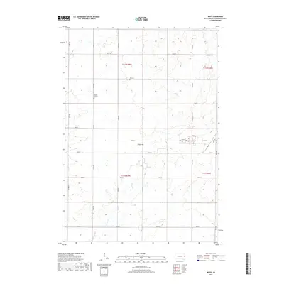
2017 Map of White
USGS Topo · Published 2017About this map
The town of White serves as the focal point of this agricultural landscape in Brookings County, situated upon the high glacial plateau of the Coteau des Prairies. The surrounding section lines are defined by a meticulous grid of rural roads, including 474th Ave and 204th St, which reflect the late-era persistence of the Public Land Survey System. Genealogical interest is concentrated in several local burying grounds, notably Fair View Cem on the eastern edge of town and the more isolated Saint Pauls Cem and Pioneer Lutheran Cem to the northwest. The drainage of Sixmile Cr meanders through the prairie, providing a natural break in the geometric regularity of the farmsteads and fields that characterize this portion of eastern South Dakota.
Find a feature on this map
29 named features on this map. Tap any name to fly to it.
Don’t see what you’re looking for? This feature index may not catch every label — zoom into the map to look around manually.
Map Details
Editions of this 2017 White Map
This is the sole edition of this map. No revisions or reprints were ever made.
Other maps of this area

1953 · Watertown
USGS Topo · 1:250,000

1958 · Watertown
USGS Topo · 1:250,000

1964 · Brookings
USGS Topo · 1:24,000

1964 · Aurora
USGS Topo · 1:24,000

1968 · Brookings NE
USGS Topo · 1:24,000

1970 · White NE
USGS Topo · 1:24,000

1970 · Astoria
USGS Topo · 1:24,000

1970 · White
USGS Topo · 1:24,000

1970 · Estelline SE
USGS Topo · 1:24,000

1970 · Toronto
USGS Topo · 1:24,000