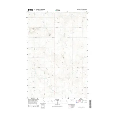
2014 Map of White Butte East
USGS Topo · Published 2014About this map
White Butte stands as a prominent landmark in this section of Hettinger County, characterized by a series of significant rises that define the local relief. The landscape is a network of drainage systems including Beaver Cr in the northeast and Thirtymile Cr cutting through the southern half, joined by the smaller Springs Cr. This 2014 survey reveals the persistent grid of the rural West, where a systematic network of section-line roads like 55th St SW and 92nd Ave SW organizes the high plains into manageable parcels. Between these routes, the terrain is marked by distinctive formations such as Campbell Butte and the Camel Buttes, providing a clear record of the physical geography used by generations of local ranchers and landowners to navigate this open country.
Find a feature on this map
20 named features on this map. Tap any name to fly to it.
Don’t see what you’re looking for? This feature index may not catch every label — zoom into the map to look around manually.
Map Details
Editions of this 2014 White Butte East Map
This is the sole edition of this map. No revisions or reprints were ever made.
Other maps of this area

1953 · Dickinson
USGS Topo · 1:250,000

1957 · Dickinson
USGS Topo · 1:250,000

1960 · White Butte West
USGS Topo · 1:24,000

1960 · White Butte NW
USGS Topo · 1:24,000

1960 · Clark Butte NW
USGS Topo · 1:24,000

1960 · White Butte NE
USGS Topo · 1:24,000

1960 · Clark Butte SW
USGS Topo · 1:24,000

1960 · White Butte East
USGS Topo · 1:24,000

1966 · Mott NW
USGS Topo · 1:24,000

1966 · Mott North
USGS Topo · 1:24,000