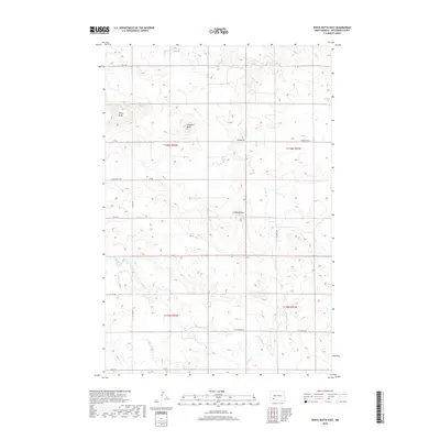
2018 Map of White Butte East
USGS Topo · Published 2018About this map
White Butte and Campbell Butte rise as prominent geological landmarks in this section of Hettinger County, defining a landscape of high plains and sharp elevations. The drainage patterns of Beaver Cr and Thirtymile Cr dictate the local topography, carving paths through the prairie. While the area is sparsely populated, the survey shows a network of section roads such as St Placidus Rd and Newburg Rd that provide access to isolated farmsteads and ranchlands. The presence of Camel Buttes in the central portion of the sheet further illustrates the distinctive erosional features common to this North Dakota region. This 2018 survey captures the intersection of traditional land survey boundaries, like t136n r93w, with the modern rural infrastructure required for agriculture and transit in the late 2010s.
Find a feature on this map
20 named features on this map. Tap any name to fly to it.
Don’t see what you’re looking for? This feature index may not catch every label — zoom into the map to look around manually.
Map Details
Editions of this 2018 White Butte East Map
This is the sole edition of this map. No revisions or reprints were ever made.
Other maps of this area

1953 · Dickinson
USGS Topo · 1:250,000

1957 · Dickinson
USGS Topo · 1:250,000

1960 · White Butte West
USGS Topo · 1:24,000

1960 · White Butte NW
USGS Topo · 1:24,000

1960 · Clark Butte NW
USGS Topo · 1:24,000

1960 · White Butte NE
USGS Topo · 1:24,000

1960 · Clark Butte SW
USGS Topo · 1:24,000

1960 · White Butte East
USGS Topo · 1:24,000

1966 · Mott NW
USGS Topo · 1:24,000

1966 · Mott North
USGS Topo · 1:24,000