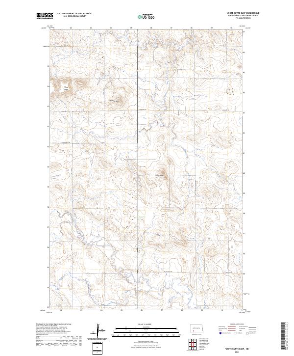
2024 Map of White Butte East
USGS Topo · Published 2024About this map
White Butte and the Camel Buttes dominate this high-plains landscape in Hettinger County, North Dakota. This modern survey reflects the enduring grid of the Public Land Survey System, where section lines are traced by local thoroughfares such as Newburg Rd and St Placidus Rd. The drainage patterns of the region are clearly defined by the winding course of Beaver Creek in the north and Thirtymile Creek further south, eventually giving way to Springs Creek at the lower edge of the quadrangle. While the terrain is characterized by these prominent buttes—including Campbell Butte—the map also documents the functional infrastructure of the contemporary ranching and farming landscape through its network of numbered routes like 93 Ave SW and 63 Rd.
Find a feature on this map
21 named features on this map. Tap any name to fly to it.
Don’t see what you’re looking for? This feature index may not catch every label — zoom into the map to look around manually.
Map Details
Editions of this 2024 White Butte East Map
This is the sole edition of this map. No revisions or reprints were ever made.
Other maps of this area

1953 · Dickinson
USGS Topo · 1:250,000

1957 · Dickinson
USGS Topo · 1:250,000

1960 · White Butte West
USGS Topo · 1:24,000

1960 · White Butte NW
USGS Topo · 1:24,000

1960 · Clark Butte NW
USGS Topo · 1:24,000

1960 · White Butte NE
USGS Topo · 1:24,000

1960 · Clark Butte SW
USGS Topo · 1:24,000

1960 · White Butte East
USGS Topo · 1:24,000

1966 · Mott NW
USGS Topo · 1:24,000

1966 · Mott North
USGS Topo · 1:24,000