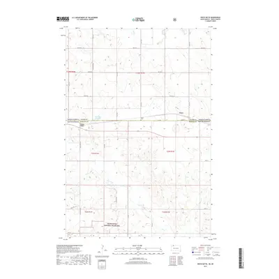
2017 Map of White Butte
USGS Topo · Published 2017About this map
Grand River National Grassland dominates the southern landscape of this Perkins County borderland, where the high plains of South Dakota meet North Dakota. The area is defined by a sparse network of section-line roads and seasonal waterways like Flat Creek and Duck Cr. Small settlements established during the rail era, such as Petrel and White Butte, sit near the state line, serving as focal points for the surrounding ranching community. The map shows the Petrel Cem tucked just south of the boundary, a vital site for local genealogical research. In addition to the natural drainage of Flat Cr, the White Butte Reservoir provides a reliable water source for the region's livestock and wildlife, illustrating the essential management of water in this semi-arid environment.
Find a feature on this map
36 named features on this map. Tap any name to fly to it.
Don’t see what you’re looking for? This feature index may not catch every label — zoom into the map to look around manually.
Map Details
Editions of this 2017 White Butte Map
This is the sole edition of this map. No revisions or reprints were ever made.
Other maps of this area

1953 · Dickinson
USGS Topo · 1:250,000

1954 · Lemmon
USGS Topo · 1:250,000

1957 · Dickinson
USGS Topo · 1:250,000

1957 · Lemmon
USGS Topo · 1:250,000

1974 · Cedar Butte
USGS Topo · 1:24,000

1974 · White Butte
USGS Topo · 1:24,000

1974 · Lemmon
USGS Topo · 1:24,000

1974 · Haynes
USGS Topo · 1:24,000

1980 · Mott
USGS Topo · 1:100,000

1983 · Haynes SE
USGS Topo · 1:24,000