
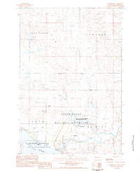
1974 Map of White Butte
USGS Topo · Published 1978About this map
Chicago Milwaukee St Paul and Pacific tracks run along the border between North and South Dakota, providing a clear industrial artery through this high plains landscape. The settlement of White Butte sits along this line, just south of the White Butte Reservoir. Further east, the small community of Petrel is marked by a grain Elevator and the Petrel Cem, indicating the area's agricultural foundations. The terrain is defined by wide drainages like Duck Creek and Flat Creek, which meander through the townships of Gilstrap, Trail, Liberty, and Flat Creek. This 1970s survey captures the region as a sparsely populated ranching and farming corridor, where landmarks like a lone Townhall or a specific BR 2453 bridge serve as vital orientation points across the open landscape.
Find a feature on this map
18 named features on this map. Tap any name to fly to it.
Don’t see what you’re looking for? This feature index may not catch every label — zoom into the map to look around manually.
Map Details
Editions of this 1974 White Butte Map
This is the sole edition of this map. No revisions or reprints were ever made.
Other maps of this area

1953 · Dickinson
USGS Topo · 1:250,000

1954 · Lemmon
USGS Topo · 1:250,000

1957 · Dickinson
USGS Topo · 1:250,000

1957 · Lemmon
USGS Topo · 1:250,000

1974 · Cedar Butte
USGS Topo · 1:24,000

1974 · Lemmon
USGS Topo · 1:24,000

1974 · Haynes
USGS Topo · 1:24,000

1980 · Mott
USGS Topo · 1:100,000

1983 · Haynes SE
USGS Topo · 1:24,000
1983 · Sommerville
USGS Topo · 1:24,000