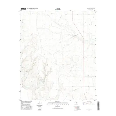
2016 Map of White Camp
USGS Topo · Published 2016About this map
The Salt Fork Brazos River winds through the southwestern corner of this West Texas terrain, where the rugged topography of Kent County is marked by dramatic canyon systems and isolated water sources. Small, naming-intensive features like Hagins Panther Canyon Lake and Pouroff Lake are situated among the breaks, providing critical water points in an otherwise arid landscape. The small settlement of White Camp sits near the headwaters of W Prong Duck Cr, serving as a central point for the network of county roads and ranch paths that crisscross the region.
Find a feature on this map
22 named features on this map. Tap any name to fly to it.
Don’t see what you’re looking for? This feature index may not catch every label — zoom into the map to look around manually.
Map Details
Editions of this 2016 White Camp Map
This is the sole edition of this map. No revisions or reprints were ever made.
Other maps of this area

1954 · Lubbock
USGS Topo · 1:250,000

1959 · Gilpin
USGS Topo · 1:24,000

1959 · Girard
USGS Topo · 1:24,000

1967 · Spur
USGS Topo · 1:24,000

1967 · Spur NW
USGS Topo · 1:24,000

1968 · Spur SW
USGS Topo · 1:24,000

1968 · White Camp
USGS Topo · 1:24,000

1969 · Clairemont East
USGS Topo · 1:24,000

1969 · Clairemont West
USGS Topo · 1:24,000

1969 · T-O Creek
USGS Topo · 1:24,000