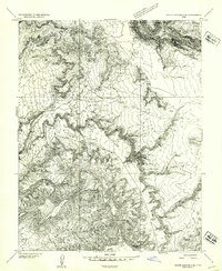
1954 Map of White Canyon 2 SE
USGS Topo · Published 1954About this map
White Canyon and Farley Canyon dominate this high-desert topography in the early 1950s, showing a landscape defined by deep drainage systems and remote resource extraction. The area serves as a borderland between Garfield and San Juan counties, where isolated infrastructure like the scattered Landing Field sites and a single labeled mine indicate the presence of prospecting and aviation support in an otherwise unpopulated region. The cartography reveals a reliance on essential water sources in an arid environment, specifically Horse Tanks, a reservoir, and a pond. Other distinctive terrain features include the sheer walls of Notch Canyon and the notable flats of Forty Acres, reflecting the extreme verticality of the Colorado Plateau before significant modern development reached these canyons.
Find a feature on this map
11 named features on this map. Tap any name to fly to it.
Don’t see what you’re looking for? This feature index may not catch every label — zoom into the map to look around manually.
Map Details
Editions of this 1954 White Canyon 2 SE Map
This is the sole edition of this map. No revisions or reprints were ever made.
Other maps of this area

1886 · Henry Mountains
USGS Topo · 1:250,000

1892 · Henry Mountains
USGS Topo · 1:250,000

1952 · Mouth of Dark Canyon
USGS Topo · 1:62,500

1952 · Mancos Mesa
USGS Topo · 1:62,500

1952 · Natural Bridges
USGS Topo · 1:62,500

1952 · Hite
USGS Topo · 1:62,500
1954 · White Canyon 2 NE
USGS Topo · 1:24,000

1954 · White Canyon 3 NW
USGS Topo · 1:24,000

1954 · White Canyon 3 NE
USGS Topo · 1:24,000
1954 · White Canyon 2 SW
USGS Topo · 1:24,000