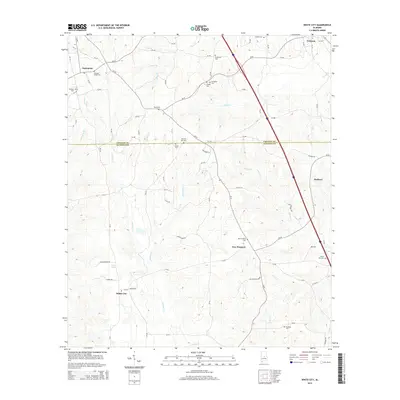
2014 Map of White City
USGS Topo · Published 2014About this map
The boundary between Chilton and Autauga Counties divides this central Alabama landscape, where several small settlements are connected by a network of county roads. Rural communities like White City, New Prospect, and Enterprise are defined by their local cemeteries and churchyards, including Bethany Cem and New Lily Hill Cem. The terrain is deeply etched by numerous waterways such as Autauga Cr and Mortar Cr, which flow through the undulating wooded hills.
Find a feature on this map
84 named features on this map. Tap any name to fly to it.
Don’t see what you’re looking for? This feature index may not catch every label — zoom into the map to look around manually.
Map Details
Editions of this 2014 White City Map
This is the sole edition of this map. No revisions or reprints were ever made.
Other maps of this area

1891 · Clanton
USGS Topo · 1:125,000

1901 · Wetumpka
USGS Topo · 1:125,000

1903 · Wetumpka
USGS Topo · 1:125,000

1953 · Montgomery
USGS Topo · 1:250,000

1956 · Montgomery
USGS Topo · 1:250,000

1957 · Montgomery
USGS Topo · 1:250,000

1959 · Billingsley
USGS Topo · 1:62,500

1959 · Elmore
USGS Topo · 1:62,500
1971 · Mitchell Dam
USGS Topo · 1:24,000
1972 · Clanton West
USGS Topo · 1:24,000