
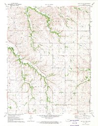
2018 Map of White City
USGS Topo · Published 2018About this map
White City serves as a primary center of settlement in this northern Morris County landscape, where a dense grid of residential streets like W Mackenzie St and Stockholm St meets the agricultural expanse. The town is flanked by the White City Cem to the northwest, while the southeastern corner of the map reveals the smaller community of Parkerville situated along the Neosho River. This drainage system, including the W Fork Neosho River, creates a network of creeks such as Parkers Cr and Lairds Cr that carve through the prairie terrain.
Find a feature on this map
62 named features on this map. Tap any name to fly to it.
Don’t see what you’re looking for? This feature index may not catch every label — zoom into the map to look around manually.
Map Details
Editions of this 2018 White City Map
This is the sole edition of this map. No revisions or reprints were ever made.
Other maps of this area

1889 · Parkerville
USGS Topo · 1:125,000

1894 · Parkerville
USGS Topo · 1:125,000

1955 · Hutchinson
USGS Topo · 1:250,000

1959 · Hutchinson
USGS Topo · 1:250,000

1964 · Skiddy
USGS Topo · 1:24,000
1964 · Wreford
USGS Topo · 1:24,000
1971 · White City NW
USGS Topo · 1:24,000
1971 · Council Grove Lake
USGS Topo · 1:24,000
1971 · Dwight
USGS Topo · 1:24,000
1971 · White City NE
USGS Topo · 1:24,000