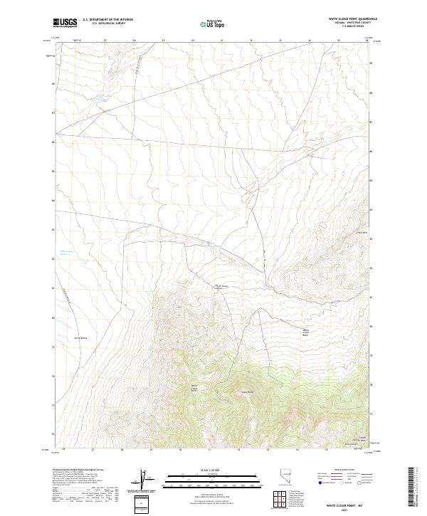
2021 Map of White Cloud Point
USGS Topo · Published 2021About this map
The high-elevation terrain of the Snake Range dominates this portion of White Pine County, showing the dramatic rise from the floor of Spring Valley to the rocky heights of White Cloud Point. This modern survey illustrates a landscape defined by seasonal drainage and steep topographic transitions, where watercourses like Spring Valley Wash and Mike Springs Wash carve routes through the arid basin. The drainage network is particularly complex around the White Cloud Basin and its associated White Cloud Canyon, which channel runoff toward the lowlands. Access to this remote region is limited to primitive routes such as Grass Valley Canyon Rd and Eight Mile Ranch Rd, which skirt the edges of the mountains. The map provides a detailed record of the township and range system, marking the boundaries of t20n r68e and t19n r69e across the desert floor and foothills like Little Hills.
Find a feature on this map
17 named features on this map. Tap any name to fly to it.
Don’t see what you’re looking for? This feature index may not catch every label — zoom into the map to look around manually.
Map Details
Editions of this 2021 White Cloud Point Map
This is the sole edition of this map. No revisions or reprints were ever made.
Other maps of this area

1956 · Ely
USGS Topo · 1:250,000

1959 · Ely
USGS Topo · 1:250,000

1963 · Ely
USGS Topo · 1:250,000
1986 · Third Butte West
USGS Topo · 1:24,000
1986 · Big Hard Pan
USGS Topo · 1:24,000
1986 · Mormon Jack Pass
USGS Topo · 1:24,000
1986 · Tippett Pass
USGS Topo · 1:24,000
1986 · Grass Valley Wash
USGS Topo · 1:24,000
1986 · White Cloud Point
USGS Topo · 1:24,000
1986 · Third Butte East
USGS Topo · 1:24,000