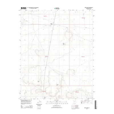
2014 Map of White Cone
USGS Topo · Published 2014About this map
White Cone is situated in a high-desert landscape defined by prominent geological formations and vital water sources. The terrain is marked by notable elevations such as White Cone Peak and Tesihim Butte, while the southern reaches of the map include the edge of the Painted Desert. Life in this arid environment revolves around seasonal water flow and perennial sources, evidenced by the presence of White Cone Spring, Rabbit Spring, and Mike Spring. In the southeast, the Pueblo Colorado Wash cuts through the landscape, a significant drainage for the region. The map shows a network of Bureau of Indian Affairs routes, including Bia-6 and Bia-9001, which connect the settlement of White Cone to the surrounding buttes and mesas, illustrating the transportation corridors vital to the Fort Defiance Agency region.
Find a feature on this map
20 named features on this map. Tap any name to fly to it.
Don’t see what you’re looking for? This feature index may not catch every label — zoom into the map to look around manually.
Map Details
Editions of this 2014 White Cone Map
This is the sole edition of this map. No revisions or reprints were ever made.
Other maps of this area

1883 · Tusayan
USGS Topo · 1:250,000

1886 · Tusayan
USGS Topo · 1:250,000

1886 · Fort Defiance
USGS Topo · 1:250,000

1892 · Fort Defiance
USGS Topo · 1:250,000

1947 · Flagstaff
USGS Topo · 1:250,000

1954 · Flagstaff
USGS Topo · 1:250,000

1954 · Gallup
USGS Topo · 1:250,000

1958 · Gallup
USGS Topo · 1:250,000

1958 · Flagstaff
USGS Topo · 1:250,000

1959 · Gallup
USGS Topo · 1:250,000