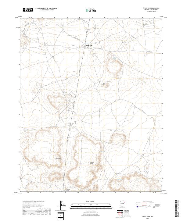
2021 Map of White Cone
USGS Topo · Published 2021About this map
White Cone serves as the central hub of this Navajo County landscape, where the high desert terrain meets a network of established tribal routes. The settlement, also labeled as Whitecone, is situated at the intersection of Navajo Svc Rte 6 and Indian Rte 9001, showing a modern infrastructure that supports this remote community. To the south, the terrain descends into the northern reaches of the Painted Desert, a stark contrast to the prominent elevations of White Cone Peak, Tesihim Butte, and Deshgish Butte. These landmarks, along with a series of vital water sources including White Cone Spring, Rabbit Spring, and Cottonwood Spring, illustrate the essential relationship between the arid environment and the locations of early and modern activity. The presence of Pueblo Colorado Wash in the southeast corner further marks the drainage patterns of this high-elevation plateau.
Find a feature on this map
21 named features on this map. Tap any name to fly to it.
Don’t see what you’re looking for? This feature index may not catch every label — zoom into the map to look around manually.
Map Details
Editions of this 2021 White Cone Map
This is the sole edition of this map. No revisions or reprints were ever made.
Other maps of this area

1883 · Tusayan
USGS Topo · 1:250,000

1886 · Tusayan
USGS Topo · 1:250,000

1886 · Fort Defiance
USGS Topo · 1:250,000

1892 · Fort Defiance
USGS Topo · 1:250,000

1947 · Flagstaff
USGS Topo · 1:250,000

1954 · Flagstaff
USGS Topo · 1:250,000

1954 · Gallup
USGS Topo · 1:250,000

1958 · Gallup
USGS Topo · 1:250,000

1958 · Flagstaff
USGS Topo · 1:250,000

1959 · Gallup
USGS Topo · 1:250,000