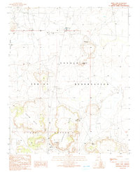
1991 Map of White Cone
USGS Topo · Published 1991About this map
The White Cone settlement and its prominent namesake landforms dominate this high-desert landscape on the Navajo Indian Reservation. This 1991 provisional survey reveals a territory defined by isolated water sources and distinct geological features, with several vital springs such as White Cone Spring, Cottonwood Spring, and Rabbit Spring serving as focal points in the arid environment. The terrain is marked by significant elevations like White Cone Peak and the sweeping formations of Tesihim Butte and the Deshgish Buttes.
Find a feature on this map
16 named features on this map. Tap any name to fly to it.
Don’t see what you’re looking for? This feature index may not catch every label — zoom into the map to look around manually.
Map Details
Editions of this 1991 White Cone Map
This is the sole edition of this map. No revisions or reprints were ever made.
Other maps of this area

1883 · Tusayan
USGS Topo · 1:250,000

1886 · Tusayan
USGS Topo · 1:250,000

1886 · Fort Defiance
USGS Topo · 1:250,000

1892 · Fort Defiance
USGS Topo · 1:250,000

1947 · Flagstaff
USGS Topo · 1:250,000

1954 · Flagstaff
USGS Topo · 1:250,000

1954 · Gallup
USGS Topo · 1:250,000

1958 · Gallup
USGS Topo · 1:250,000

1958 · Flagstaff
USGS Topo · 1:250,000

1959 · Gallup
USGS Topo · 1:250,000