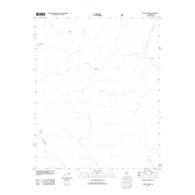
2012 Map of White Dome
USGS Topo · Published 2012About this map
The S Fork Kern River defines the central drainage of this high-elevation landscape in Kern County, flowing through a region of prominent peaks and alpine valleys. To the northwest, White Dome and Black Mountain overlook a complex network of tributaries including Manter Cr and Taylor Cr. The eastern portion of the area is characterized by the broad stretch of Long Valley, where human transit is marked by isolated corridors like Long Valley Rd and Chimney Basin Rd. This area reflects the remote character of the southern Sierras, dominated by natural drainage patterns such as Palome Cr and Bartolas Cr rather than dense settlement. The presence of Forest Service roads like 25s22 and 25s13 provides a record of land management and access routes used for backcountry navigation and resource oversight.
Find a feature on this map
15 named features on this map. Tap any name to fly to it.
Don’t see what you’re looking for? This feature index may not catch every label — zoom into the map to look around manually.
Map Details
Editions of this 2012 White Dome Map
This is the sole edition of this map. No revisions or reprints were ever made.
Other maps of this area

1906 · Kernville
USGS Topo · 1:125,000

1908 · Kernville
USGS Topo · 1:125,000

1943 · Onyx
USGS Topo · 1:62,500

1943 · Isabella
USGS Topo · 1:62,500

1948 · Bakersfield
USGS Topo · 1:250,000

1955 · Bakersfield
USGS Topo · 1:250,000

1956 · Bakersfield
USGS Topo · 1:250,000
1956 · Kernville
USGS Topo · 1:62,500
1956 · Lamont Peak
USGS Topo · 1:62,500

1960 · Bakersfield
USGS Topo · 1:250,000