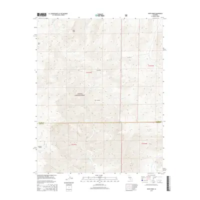
2015 Map of White Dome
USGS Topo · Published 2015About this map
The S Fork Kern River winds through the high-elevation terrain of the Sierra Nevada mountains along the border of Tulare and Kern counties. This part of the Sequoia National Forest is defined by prominent peaks like White Dome and Black Mtn, providing a look at the land's drainage patterns through numerous tributaries such as Manter Cr and Taylor Cr. The map shows the intersection of public lands, including the Blm Long Vly administrative area within the wider Long Valley. At the southern end of the sheet, the settlement area of Bartolas Country lies near the headwaters of Bartolas Cr. The intricate contour lines reveal the steep elevation changes between the river basin and the surrounding granite domes and ridges during the early 21st century.
Find a feature on this map
18 named features on this map. Tap any name to fly to it.
Don’t see what you’re looking for? This feature index may not catch every label — zoom into the map to look around manually.
Map Details
Editions of this 2015 White Dome Map
This is the sole edition of this map. No revisions or reprints were ever made.
Other maps of this area

1906 · Kernville
USGS Topo · 1:125,000

1908 · Kernville
USGS Topo · 1:125,000

1943 · Onyx
USGS Topo · 1:62,500

1943 · Isabella
USGS Topo · 1:62,500

1948 · Bakersfield
USGS Topo · 1:250,000

1955 · Bakersfield
USGS Topo · 1:250,000

1956 · Bakersfield
USGS Topo · 1:250,000
1956 · Kernville
USGS Topo · 1:62,500
1956 · Lamont Peak
USGS Topo · 1:62,500

1960 · Bakersfield
USGS Topo · 1:250,000