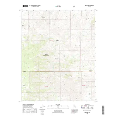
2018 Map of White Dome
USGS Topo · Published 2018About this map
The S Fork Kern River defines the drainage of this high-elevation landscape within the Sequoia National Forest. Centered on the towering White Dome and Black Mtn, the terrain is characterized by steep canyons and named valleys such as Long Valley. The intersection of the Tulare Co Kern Co line marks a significant boundary across the center of the sheet, dividing these southern Sierra Nevada reaches. While largely wilderness, the presence of Bartolas Country in the southwest corner and the network of streams like Manter Cr and Taylor Cr provide specific points of reference for those tracking land use and geographic history in the Kern County high country. The map also traces seasonal drainages including Palome Cr and Chimney Cr as they feed into the larger river system.
Find a feature on this map
18 named features on this map. Tap any name to fly to it.
Don’t see what you’re looking for? This feature index may not catch every label — zoom into the map to look around manually.
Map Details
Editions of this 2018 White Dome Map
This is the sole edition of this map. No revisions or reprints were ever made.
Other maps of this area

1906 · Kernville
USGS Topo · 1:125,000

1908 · Kernville
USGS Topo · 1:125,000

1943 · Onyx
USGS Topo · 1:62,500

1943 · Isabella
USGS Topo · 1:62,500

1948 · Bakersfield
USGS Topo · 1:250,000

1955 · Bakersfield
USGS Topo · 1:250,000

1956 · Bakersfield
USGS Topo · 1:250,000
1956 · Kernville
USGS Topo · 1:62,500
1956 · Lamont Peak
USGS Topo · 1:62,500

1960 · Bakersfield
USGS Topo · 1:250,000