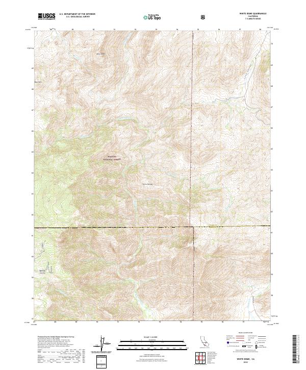
2022 Map of White Dome
USGS Topo · Published 2022About this map
The Kern Wild and Scenic River carves a deep path through the high-elevation landscape of the Sequoia National Forest, serving as the primary hydrological feature of this quadrangle. Located within the Sierra Nevada range, the terrain is defined by dramatic peaks and valleys, including White Dome and Black Mtn. The map highlights the transition from the rugged topography of Bartolas Country to the expansive Long Valley in the northeast. While the area is largely characterized by its natural features and drainage systems like Manter Cr and Taylor Cr, a single road, Mallory Rd, appears in the southeast corner. This 2022 survey illustrates the intersection of Tulare and Kern Counties, providing a clear look at federal land boundaries and protected river corridors in a high-wilderness setting.
Find a feature on this map
20 named features on this map. Tap any name to fly to it.
Don’t see what you’re looking for? This feature index may not catch every label — zoom into the map to look around manually.
Map Details
Editions of this 2022 White Dome Map
This is the sole edition of this map. No revisions or reprints were ever made.
Other maps of this area

1906 · Kernville
USGS Topo · 1:125,000

1908 · Kernville
USGS Topo · 1:125,000

1943 · Onyx
USGS Topo · 1:62,500

1943 · Isabella
USGS Topo · 1:62,500

1948 · Bakersfield
USGS Topo · 1:250,000

1955 · Bakersfield
USGS Topo · 1:250,000

1956 · Bakersfield
USGS Topo · 1:250,000
1956 · Kernville
USGS Topo · 1:62,500
1956 · Lamont Peak
USGS Topo · 1:62,500

1960 · Bakersfield
USGS Topo · 1:250,000