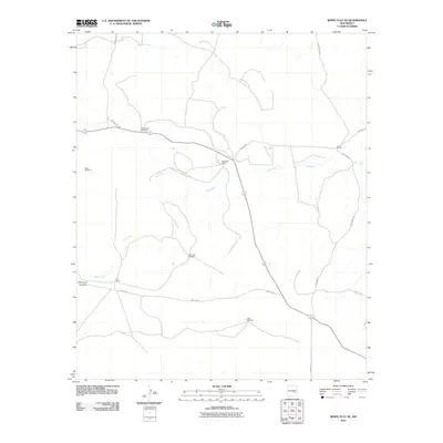
2010 Map of White Flat SE
USGS Topo · Published 2010About this map
Childress Ranch and several family-named outposts anchor this arid landscape in Chaves County, where ranching operations rely on a network of scattered water sources. The map reveals a distribution of isolated infrastructure, including the Partnership Windmill, Big Creek Windmill, and South Windmill, which are critical for livestock and human habitation in this New Mexico environment.
Find a feature on this map
15 named features on this map. Tap any name to fly to it.
Don’t see what you’re looking for? This feature index may not catch every label — zoom into the map to look around manually.
Map Details
Editions of this 2010 White Flat SE Map
This is the sole edition of this map. No revisions or reprints were ever made.
Other maps of this area

1949 · Corn Ranch
USGS Topo · 1:24,000

1950 · Corn Ranch
USGS Topo · 1:24,000

1955 · Roswell
USGS Topo · 1:250,000

1958 · Roswell
USGS Topo · 1:250,000

1962 · Roswell
USGS Topo · 1:250,000

1962 · Horseshoe Bend
USGS Topo · 1:62,500

1962 · Rock House Canyon
USGS Topo · 1:24,000
1963 · Barn Draw
USGS Topo · 1:24,000

1967 · White Flat
USGS Topo · 1:24,000
1967 · White Flat SE
USGS Topo · 1:24,000