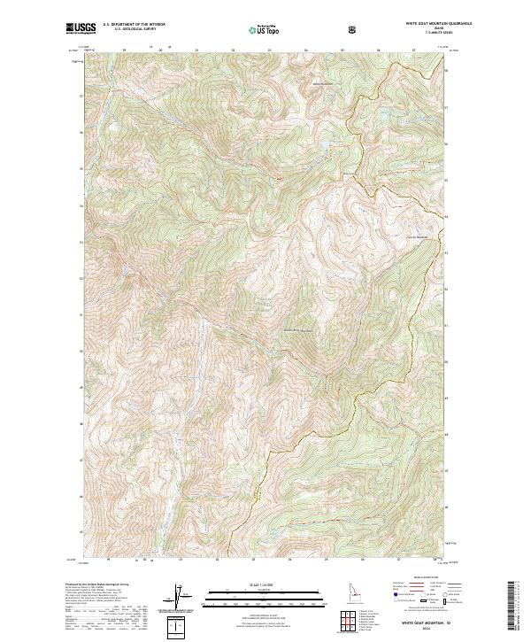
2024 Map of White Goat Mountain
USGS Topo · Published 2024About this map
White Mountain and the White Goat Mtn massif dominate this high-elevation landscape within the Challis National Forest. Situated along the boundary of Lemhi Co and Custer Co, the terrain is defined by the protected wilderness of the Frank Church-River of No Return Wilderness. The map reveals a complex network of pack trails, such as the White Goat Creek Trl and Camas-Eddy Creek Trl, which connect remote alpine features like White Goat Lake and Eddy Lake. The drainage patterns of the Salmon River Mountains are clearly visible, with Camas Creek and Fell Creek carving through the steep topography. This modern survey provides a detailed look at the trail systems and natural hydrology of the region, including high meadows such as Camas Meadows and the clusters of the West Fork Lakes.
Find a feature on this map
28 named features on this map. Tap any name to fly to it.
Don’t see what you’re looking for? This feature index may not catch every label — zoom into the map to look around manually.
Map Details
Editions of this 2024 White Goat Mountain Map
This is the sole edition of this map. No revisions or reprints were ever made.
Other maps of this area

1930 · Casto
USGS Topo · 1:125,000

1956 · Twin Peaks
USGS Topo · 1:62,500

1957 · Challis
USGS Topo · 1:250,000

1960 · Challis
USGS Topo · 1:250,000

1963 · Challis
USGS Topo · 1:250,000

1963 · Challis Creek Lakes
USGS Topo · 1:24,000

1963 · Meyers Cove
USGS Topo · 1:24,000
1963 · Sheldon Peak
USGS Topo · 1:24,000
1963 · Black Mtn
USGS Topo · 1:24,000
1963 · Meyers Cove Point
USGS Topo · 1:24,000